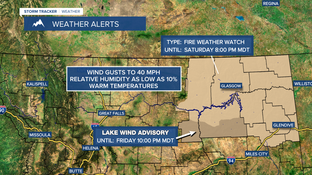
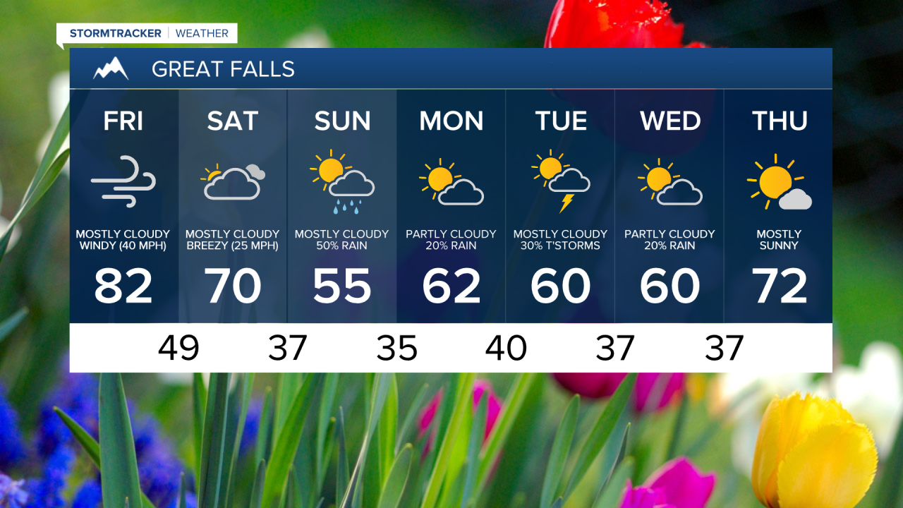
Today well be a very warm day across the region with many areas reaching highs into the 80s. With that will come strong winds, very low humidity, and the potential for any fire starts to spread rapidly. A Red Flag Warning has been issued to cover this threat.
Tomorrow, North-Eastern Montana is under a Fire Weather Watch as well as a Lake Wind Advisory for the Fort Peck area.

Later in the weekend we have the potential for some precipitation, and while we'll take what we can get, we don't expect widespread, beneficial precipitation to make a dent into the drought situation. Highs will drop to right around average (low 60s). Unsettled weather will continue through Wednesday, but then things begin to warm up once again by Thursday with highs back in the 70s and sunshine returning.


