A HIGH WIND WARNING is in effect for a lot of western Montana until 11pm Friday or 3am Saturday; for a lot of central Montana until 6am/12pm Saturday; and for northeastern Montana from 9pm Friday until 9pm Saturday.
A HIGH WIND WATCH is in effect for portions of southeastern Montana from 3am until 6pm Saturday.

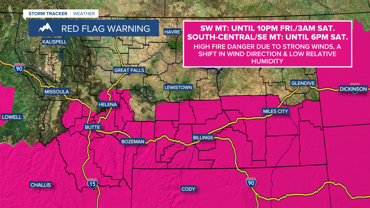
A RED FLAG WARNING is in effect for most of southwestern Montana until 10pm Friday or 3am Saturday.
A RED FLAG WARNING is in effect for south-central and southeastern Montana until 6pm Saturday.

A strong cold front is going to pass through Montana this evening and tonight. Right now, the cold front is expected to pass through north-central Montana between 6pm and midnight. When the cold front passes through, there will be a sharp uptick in the winds and there will be a wind direction change from the south/southwest to the west. Along and behind the cold front, it is going to be very windy with sustained wind speeds between 20 and 40 mph and wind gusts between 50 and 70 mph. Isolated locations may even see wind gusts up to 80 mph, especially along the Rocky Mountain Front.
This wind will likely cause some wind damage (broken tree limbs/branches, downed power lines, blowing debris), so if you have anything outside that can easily blow away (like Halloween decorations), please weigh it down or take it inside as soon as possible. A few hours after the cold front passes through, the wind will begin to diminish, although it will still be windy with wind gusts over 40 mph possible.

We are also going to have partly to mostly cloudy skies this evening and early tonight, with decreasing clouds later on tonight. There are also going to be scattered rain and mountain snow showers around this evening and tonight along the Rocky Mountain Front and along/west of the Continental Divide. East of the Divide and east of the Rocky Mountain Front, there are just going to be a few scattered rain showers around tonight. Also, most of the precipitation that falls tonight will be before midnight. It is also going to be cool tonight as lows are going to be in the upper 30s and low to mid 40s in most locations.
For tomorrow, we are going to have lots of sunshine, mainly dry conditions, and cooler temperatures as highs are going to be in the 60s in most locations. We are also going to have widespread gusty winds around tomorrow as sustained wind speeds are going to be between 10 and 30 mph, and wind gusts up to 40 mph are possible. The strongest wind tomorrow is going to be in northeastern Montana and along the Rocky Mountain Front, where wind gusts up to 50 mph are possible. This wind will begin to diminish in some areas tomorrow afternoon and will diminish for everyone tomorrow evening.
On Sunday, we are going to have gorgeous weather as we are going to have mostly sunny skies, mainly dry conditions, and mild temperatures as highs are going to be in the low to mid 70s. There is also going to be a lot less wind around on Sunday as sustained wind speeds are going to be between 5 and 15 mph in most locations. Along the Rocky Mountain Front, it will continue to be breezy on Sunday as sustained wind speeds are going to be between 10 and 20 mph.
Beautiful, summer-like weather is then expected from Monday through Wednesday as an upper-level ridge is going to be in control of our weather. On these three days, we are going to have lots of sunshine, dry conditions, and warm temperatures as highs are going to be in the mid to upper 70s and low to mid 80s. It is also going to be breezy in some areas on Monday and Tuesday as sustained wind speeds are going to be between 10 and 20 mph.
We are then going to have partly to mostly cloudy skies and mainly dry conditions on Thursday and Friday as a couple weak disturbances pass through our area. The temperatures are also going to cool down some over these two days as highs are going to be in the 70s and low to mid 80s on Thursday and the mid to upper 60s and low to mid 70s on Friday. There is also going to be a little breeze around on these two days as sustained wind speeds are going to be between 5 and 20 mph.


