A WINTER WEATHER ADVISORY is in effect for northeastern Montana as well as some of the mountains in central, north-central, and southwestern Montana until 11pm Wednesday or 5am Thursday.

A WINTER STORM WATCH is in effect for the Bears Paw mountains, the Highwoods, the Judith mountains, the Little Belts, and the Snowies from 5pm Friday until 5pm Saturday.

Gusty winds will continue tonight in locations east of a line from Havre to Stanford as wind gusts over 40 mph are possible. This wind will weaken some as the night goes on though. West of a line from Havre to Stanford, it is just going to be a little breezy tonight. We are also going to have mostly cloudy skies tonight, with some clearing during the second half of the night. A few areas of fog may also develop later on tonight. It is also going to be chilly tonight as lows are going to be in the mid to upper teens and low to mid 20s.
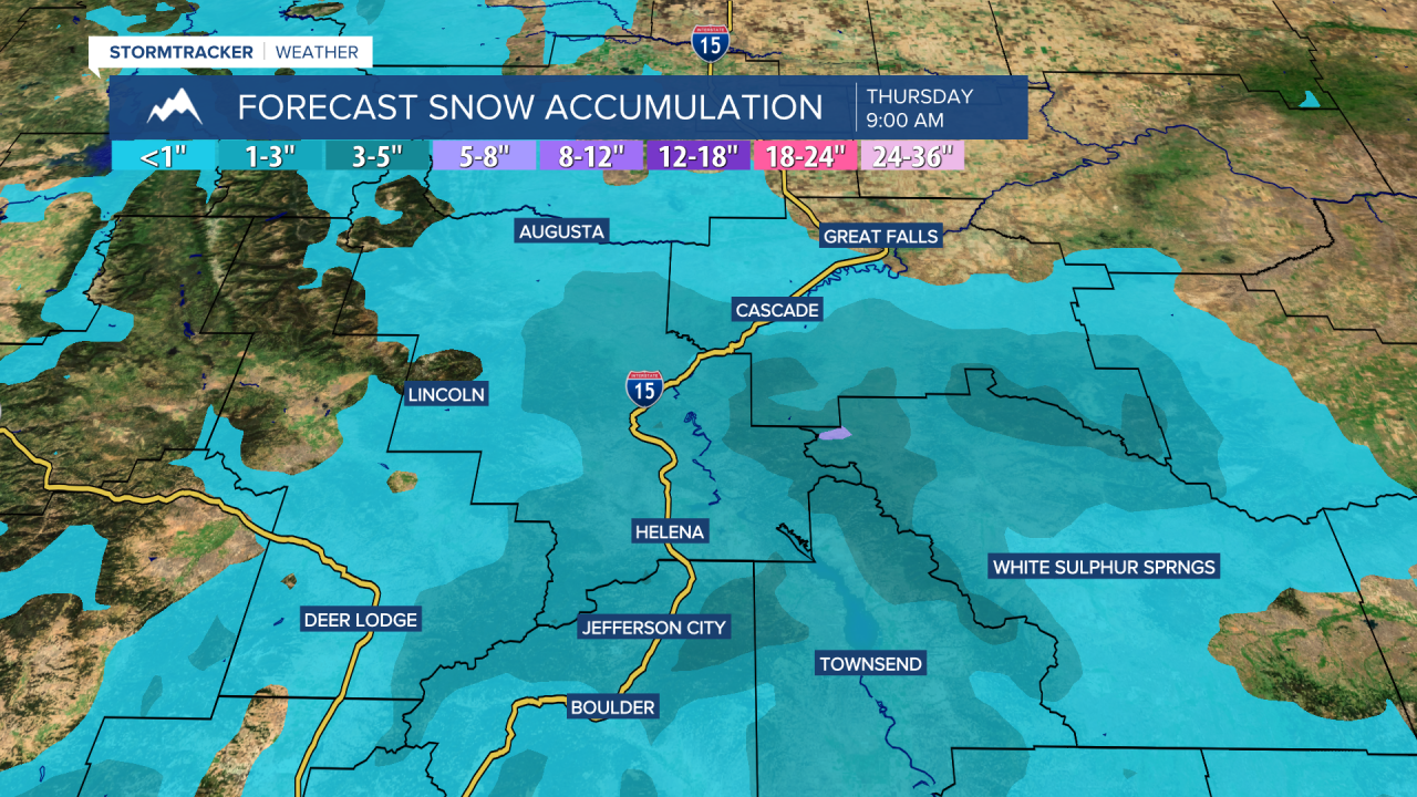
Snow is likely tonight around Helena, generally before 2am, and there are going to be a few snow showers around tonight in western and southern portions of north-central Montana. Most of the lower elevations will see <.5” of new snow, but around Helena, up to 2 or 3” of snow is possible. In the mountains, up to 6” of new snow is possible through tomorrow morning. This snow will create slippery road conditions, so please use caution when driving.

For tomorrow, we are going to have beautiful weather as we are going to have partly to mostly sunny skies (via decreasing clouds), mainly dry conditions, and seasonable temperatures as highs are going to be in the upper 20s and low to mid 30s. There are also going to be a few areas of fog around tomorrow, including in the Helena Valley, and some of this fog may be dense at times. We are also going to have increasing wind tomorrow along the Rocky Mountain Front and it is going to be a bit breezy tomorrow in eastern portions of north-central Montana as sustained wind speeds are going to be between 10 and 20 mph.
Gusty to strong winds will then return to our area on Friday as wind gusts over 70 mph are possible along/just east of the Rocky Mountain Front, and gusts over 40 mph are possible elsewhere. It is also going to feel nice outside on Friday as highs are going to be in the mid to upper 30s and low to mid 40s. We are also going to have mostly cloudy skies on Friday with a few rain and snow showers around, mainly during the afternoon/evening and generally in the mountains and along the Hi-Line, as an upper-level trough begins to impact our area.
There are then going to be areas of light to moderate snow around Friday night, and there are going to be scattered areas of snow around this weekend, especially in locations east of I-15, as this trough continues to impact the state. The mountains will likely see heavy snow out of this storm system, with most mountain ranges getting at least 5" of snow. In central Montana, some of the mountain ranges may see over 2 feet of snow from midday Friday through Monday morning (this includes Showdown). Be prepared for difficult to impossible travel conditions at and above mountain pass level.
In the lower elevations, up to 6" of snow is possible this weekend, although higher amounts are expected in northerly upslope regions in central Montana, like around Lewistown and Stanford. This is where snow accumulations could approach or even exceed a foot.

We are also going to have mostly cloudy to overcast skies this weekend with highs in the mid to upper 20s and low to mid 30s in most locations (teens in northeastern Montana on Sunday). It is also going to be a bit breezy in some areas this weekend as sustained wind speeds are going to be between 10 and 20 mph.
On Monday, we are going to have partly to mostly sunny skies with a couple lingering snow showers around during the morning as this trough leaves our area. We are then going to have mostly sunny skies and dry conditions on Tuesday and Wednesday as an upper-level ridge is going to be in control of our weather.
Highs on Monday are going to be in the 20s and low 30s. It is then going to be warmer on Tuesday and Wednesday as highs are going to be in the 30s in most locations. It is also going to be breezy in some areas on these three days as sustained wind speeds are going to be between 10 and 20 mph.


