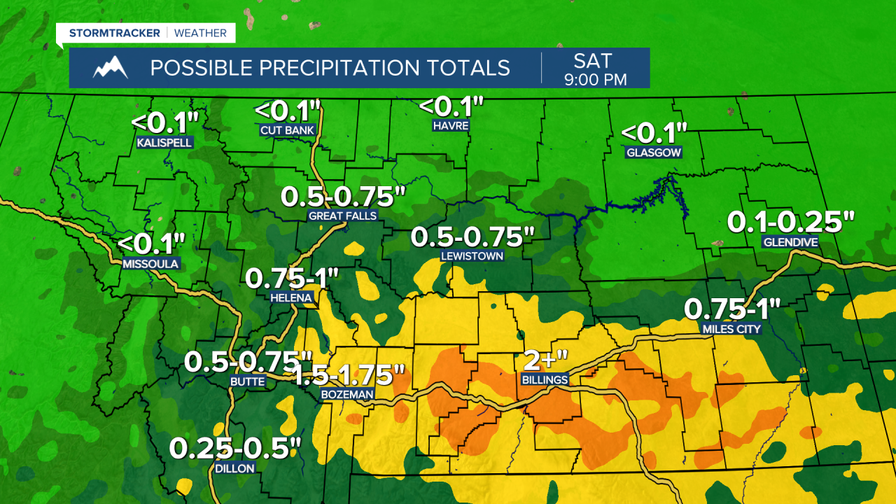
A FLOOD WATCH is in effect for portions of eastern and southern Montana from 6am Friday until 6am Sunday. Flooding due to excessive rainfall is possible.

We are going to have mostly clear skies and mainly dry conditions tonight. It is also going to be warmer tonight than it has been over the past couple of nights as lows are going to be in the 40s and low 50s in most locations, which means no frost and no record lows!
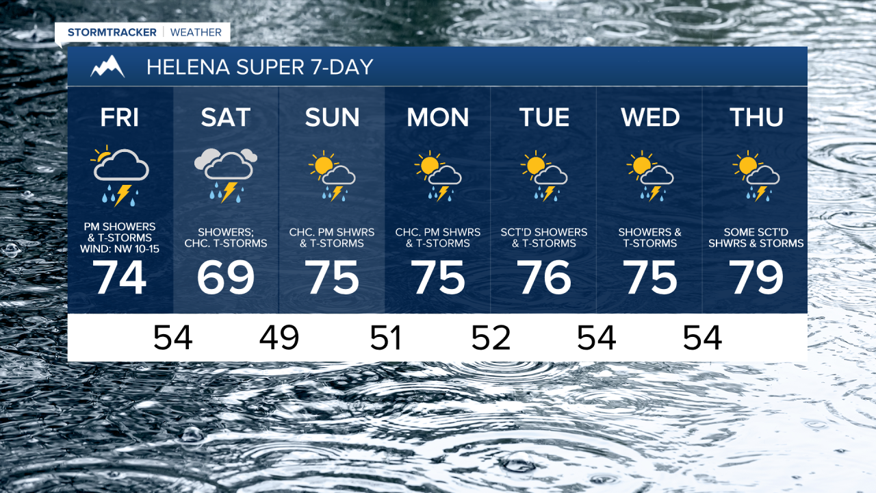
For tomorrow, we are going to have increasing clouds throughout the day with showers and thunderstorms likely during the afternoon and evening, especially in central and southern Montana. There are then going to continue to be showers and thunderstorms around tomorrow night, especially in central and southern Montana. On Saturday, we are going to have mostly cloudy skies with showers likely in central Montana and scattered showers in north-central Montana. Some thunderstorms are also possible on Saturday.

Some of the rain that falls tomorrow and tomorrow night will be heavy, especially in central and southern Montana, and this heavy rainfall may lead to some flash flooding. Also, the rainfall amounts between Friday morning and Saturday evening are going to vary a lot across the state. Northern and western portions of Montana will receive the least amount of rainfall, while central and southern portions of Montana, especially east of I-15, will receive the most rainfall. Along the Hi-Line, less than a quarter inch of rainfall is expected in most locations. In central Montana, including around the Great Falls, Helena, and Lewistown areas, a general .5 to 1.5 inches of rainfall is expected, with localized higher amounts. In southern Montana east of I-15, 1 to 2+ inches of rainfall is expected, with localized higher amounts.
Highs tomorrow and Saturday are going to be in the 60s and low to mid 70s in most locations, with tomorrow being the warmer day. It is also going to be a bit breezy tomorrow as sustained wind speeds are going to be between 10 and 20 mph.
Nicer weather is then expected on Sunday as we are going to have partly cloudy skies, drier conditions (just some isolated showers and thunderstorms around), and warmer temperatures as highs are going to be in the 70s and low 80s in most spots.
On Monday, we are going to have partly cloudy skies with a few scattered showers and thunderstorms around, generally during the afternoon/evening and especially in the mountains. There are then going to be some scattered showers and thunderstorms around on Tuesday, generally during the second half of the day. We are also going to have partly cloudy skies on Tuesday. Scattered showers and thunderstorms are then expected on Wednesday, especially during the afternoon and evening. More of the same is then expected on Thursday with partly cloudy skies and some scattered showers and thunderstorms around. It is also going feel nice outside next week as highs are going to range from the mid 60s to the low 80s, with most locations topping out in the 70s.