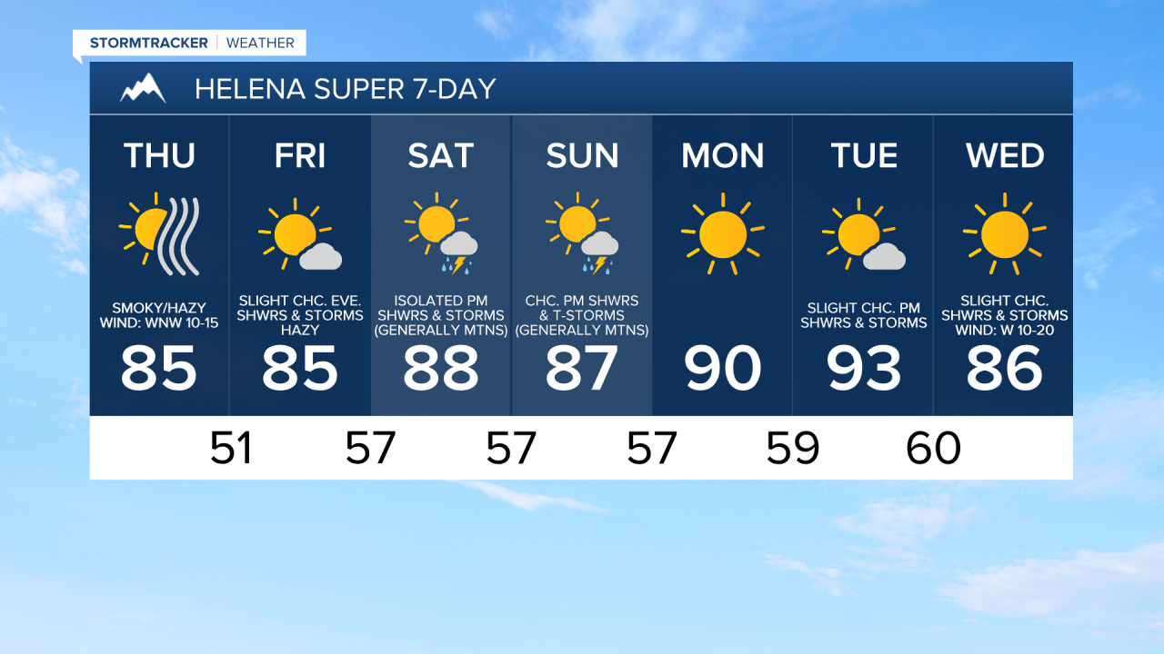
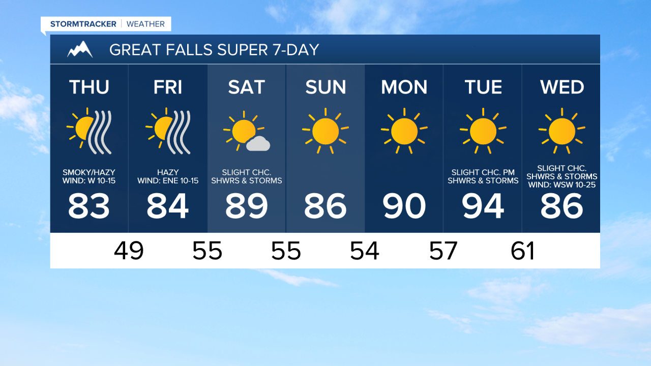
Haze/smoke from wildfires off to our west and northwest is going to increase as we go through this evening and tonight. Widespread haze/smoke is then expected tomorrow. A cold front will then clear some of the haze/smoke out as we go through tomorrow night, but it will continue to be hazy on Friday. Most of this haze and smoke will be aloft, so the air quality won’t be terrible, but at times the air quality may be unhealthy for sensitive groups, especially tonight and tomorrow.
Outside of the haze/smoke, we are going to have mostly clear skies tonight; lots of sunshine tomorrow; mostly to mainly clear skies tomorrow night; and mostly to mainly sunny skies on Friday as high pressure is going to be in control of our weather. For tonight, a couple isolated showers and thunderstorms are possible, but a majority of the state is going to be dry. Dry conditions are then expected throughout the entire state tomorrow and tomorrow night. A few isolated showers and thunderstorms are then possible around the Helena area Friday evening as the next disturbance begins to approach our area.
It is also going to be breezy tomorrow, especially during the afternoon and evening, as sustained wind speeds are going to be between 10 and 20 mph, and wind gusts over 30 mph are possible. This wind is initially going to be coming out of the west-southwest, but it will eventually switch to come out of the northwest later in the day. There is also going to be a little breeze around on Friday as sustained wind speeds are going to be between 5 and 20 mph, and this wind is going to be coming out of the east/southeast. We are also going to have pleasant temperatures tomorrow and Friday as highs are going to be in the mid to upper 70s and low to mid 80s in most locations.
On Saturday, we are going to have mostly to mainly sunny skies with some isolated showers and thunderstorms around, generally during the PM hours and generally in the mountains. We are then going to have mostly to mainly sunny skies on Sunday with a chance of PM showers and thunderstorms in central Montana, including around the Helena area, and mostly dry conditions in north-central Montana. It is also going to be very warm this weekend as highs are going to be in the 80s and low 90s in most locations.
Lots of sunshine and mostly dry conditions are then expected on Monday and Tuesday as high pressure is going to be in control of our weather. It is also going to be hot on these two days as highs are going to be in the mid to upper 80s and low to mid 90s in most locations.
A few isolated showers and thunderstorms are then possible on Wednesday as a disturbance passes through our area. We are also going to have gusty winds and cooler temperatures on Wednesday as sustained wind speeds are going to be between 10 and 25 mph, and high temperatures are going to be in the 80s in a lot of locations.