


A RED FLAG WARNING is in effect for southwestern and portions of central Montana from 2pm Saturday until 12am Sunday.

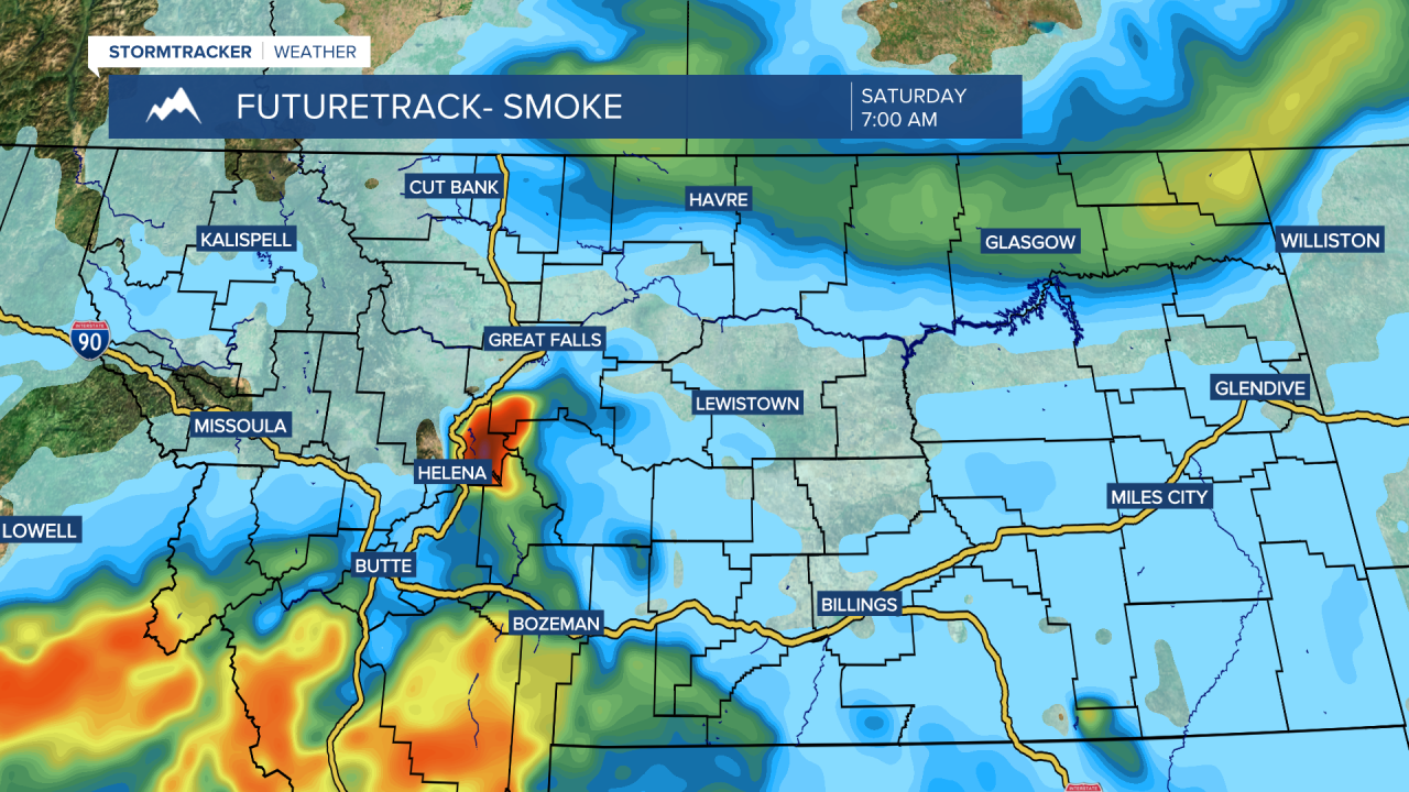
Hazy skies are expected throughout the weekend due to smoke from local and regional wildfires. It is also going to be smoky at times this weekend in some areas, specifically in southwestern and south-central Montana. When it is smoky, that means the air quality will likely be unhealthy for sensitive groups if not unhealthy for everyone, so you may want to limit your time outdoors during those times.
Outside of the haze/smoke, we are going to have mainly clear skies tonight; mostly sunny skies tomorrow; and partly cloudy skies around Helena and mainly sunny skies in north-central Montana on Sunday. Most locations are also going to be dry this weekend, but a stray shower or thunderstorm is possible tonight and on Sunday, and there will be some scattered showers and thunderstorms around tomorrow afternoon/evening along the eastern half of the Hi-Line (in Blaine County, Hill County, Phillips County, and Valley County). A few of the showers/storms that develop later tomorrow may also be severe with damaging winds (58+ mph) and/or large hail (1+” in diameter). Lightning from these storms may also spark a few new fires. A stray tornado is also possible tomorrow afternoon/evening.

There is also going to be a breeze around in some areas tomorrow and Sunday, generally during the PM hours, as sustained wind speeds are going to be between 10 and 20 mph, and wind gusts up to 35 mph are possible. This wind coupled with low relative humidity and hot temperatures will create high fire danger allowing new fire starts and current fires to rapidly spread, so please do your part to not start any new fires. It is also going to be hot this weekend as highs are going to be in the 90s and upper 80s in most locations.
Lots of sunshine is then expected on Monday and Tuesday and mostly sunny skies are expected Wednesday through Friday as an upper-level ridge is going to be in complete control of our weather. Most locations are also going to continue to remain dry next week, but a couple stray showers/thunderstorms are possible every day. It is also going to be hot next week as highs are going to be in the 90s and mid to upper 80s in most locations. Fire danger will also continue to remain high next week, but luckily the wind will be on the lighter side for most of the week with sustained wind speeds between 5 and 15 mph.


