


There are going to be a few showers and thunderstorms around this evening and early tonight, mainly along the Hi-Line. We are also going to have mostly clear and hazy skies tonight. The wind is also going to diminish this evening, with just a little breeze around overnight. It is also going to be cool tonight as lows are going to be in the 50s and upper 40s.
For tomorrow, we are going to have increasing clouds with some scattered showers and thunderstorms around, generally during the afternoon/evening and especially in north-central and northeastern Montana, as a disturbance passes through our area. A few of the thunderstorms that develop later on tomorrow in northern Montana (east of I-15) may also be severe with damaging winds (58+ mph gusts) and/or large hail (>1” in diameter).

It is also going to be hazy again tomorrow, and the haze/smoke is going to thicken some as the day goes on along portions of the Hi-Line and in northeastern Montana. There is also going to be a breeze around tomorrow as sustained wind speeds are going to be between 10 and 25 mph, and wind gusts up to 40 mph are going to be possible at times. We are also going to have pleasant temperatures tomorrow as highs are going to be in the mid to upper 70s and low to mid 80s.
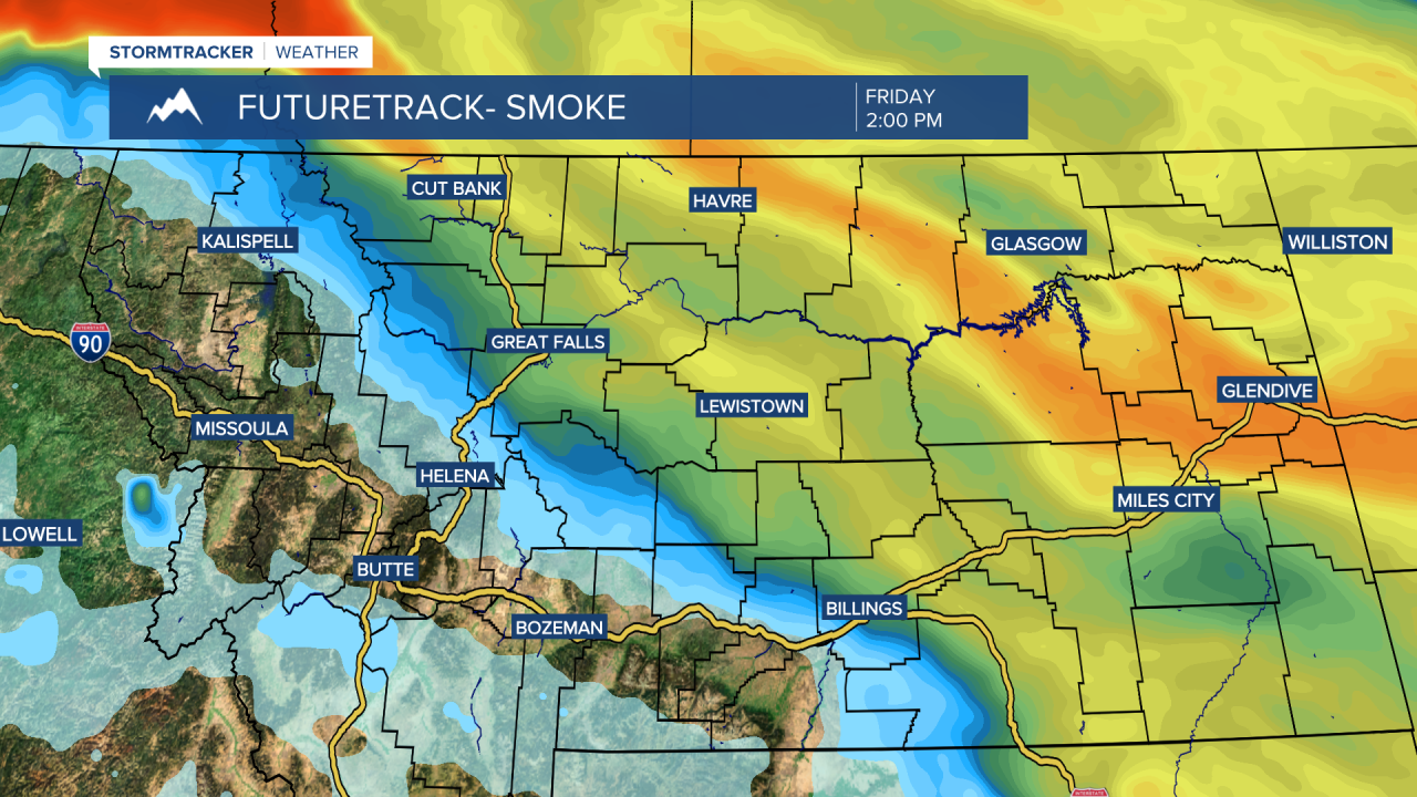
On Friday, we are going to have increasing clouds with a chance of showers and thunderstorms, generally during the afternoon/evening and generally in north-central Montana, as another disturbance passes through our area. We are also going to have widespread haze/smoke around on Friday in central and eastern Montana (east of the Divide), and the air quality will probably be unhealthy for sensitive groups in these areas.
It is also going to be a bit breezy on Friday, especially in locations east of I-15, as sustained wind speeds are going to be between 10 and 20 mph, and wind gusts over 30 mph are going to be possible at times. We are also going to have pleasant temperatures again on Friday as highs are going to be in the mid to upper 70s and low to mid 80s.
For this weekend, we are going to have mostly to mainly sunny skies and mainly dry conditions as an upper-level ridge is going to be in control of our weather. The temperatures are also going to warm up some this weekend as highs are going to be in the 80s on Saturday and the mid to upper 80s and low to mid 90s on Sunday. It is also going to be a bit breezy on Sunday as sustained wind speeds are going to be between 10 and 20 mph.
Monday is then going to be the hottest day of the year so far as highs are going to be in the 90s in most locations. It is also going to be breezy on Monday as sustained wind speeds are going to be between 10 and 20 mph. We are also going to have mostly sunny skies on Monday with a slight chance of PM showers and thunderstorms.
Lots of sunshine and dry conditions are then expected on Tuesday and Wednesday as an upper-level ridge is going to continue to be in control of our weather. It is also going to be warm on these two days as highs are going to be in the 80s in most locations, and it is going to be breezy on Tuesday as sustained wind speeds are going to be between 10 and 25 mph.


