


Monday night was the coldest night of this winter so far as low temperatures were in the -10s, -20s, and -30s in most locations, and wind chills were in the -30s, -40s, and -50s for a lot of the night.

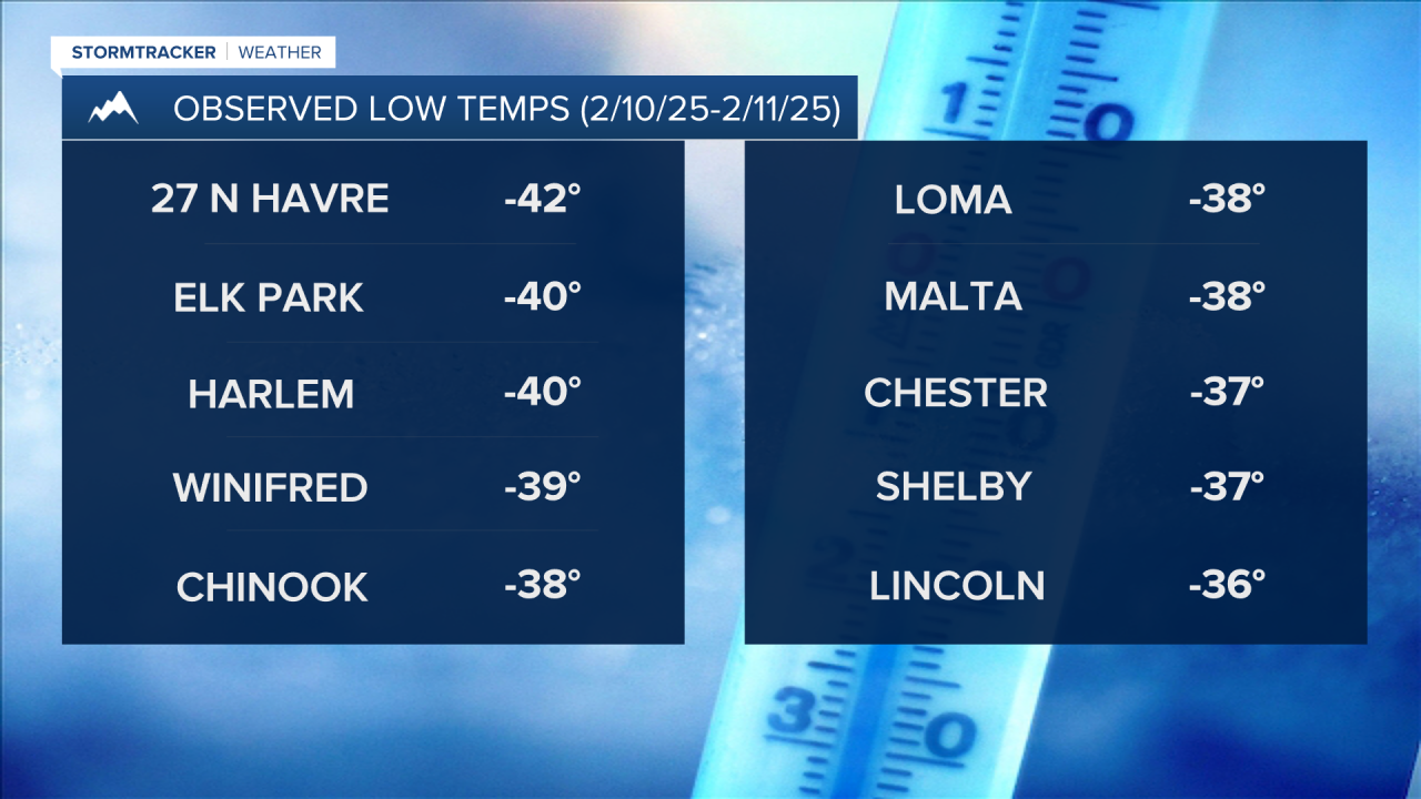
The coldest wind chill in the state last night was -60° at a weather station 27 miles north of Havre, and the coldest low temperature in north-central and northeastern Montana last night was -42° located at that same weather station 27 miles north of Havre.

These dangerous wind chills also prompted several school districts to delay or close school today (February 11, 2025) for the safety of the students and staff.

Tuesday night will be another cold night, but it won't be as cold as it was last night as lows are going to be in the -10s and -20s, and wind chills are going to be in the -10s, -20s, and -30s in most locations.
For Tuesday night and Wednesday morning, the coldest wind chills and air temperatures will be along and north of the Hi-Line, and that's where an Extreme Cold Warning is in effect.
The rest of the state is just under a Cold Weather Advisory for tonight. Stay warm!

